The Last Leg, part 2
I was up again at 5:00 and out of the harbor by 5:15. There was a fair breeze for so
early in the morning, and Buzzards Bay was rather lumpy. I had about a 30 mile ride, with following seas
and lots of rolling and broaching. At least I had a fair tide so that helped
shorten the trip.
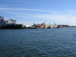 |
Just at the western end of the Cape Cod canal is the Mass Maritime Academy,
and their training ship and tug. |
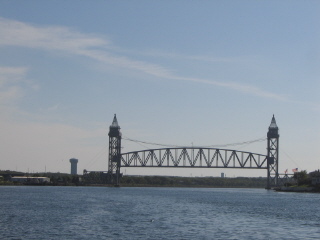 |
Then its the Borne Railroad bridge- this bridge is always open, and I had seen it
from several miles out in the bay, but when I rounded the bend it was down, but just starting
to go up. With the tide pushing me I was over 13 mph, so I was glad I didn't have to
wait long for it to be high enough for me to get under. |
My daughter and her husband, Dave, met me at the eastern end of the canal so he could
join me for the rest of the trip. There is a small
'harbor of refuge' there, as its labeled on the charts, but the town of Sandwich sees
it as some kind of gold mine- they charge $7 per hour to tie up. I had to wait about an hour,
and then I decided to fill up with fuel, so the dock guy didn't charge me the waiting fee.
We were out of the canal and on Mass Bay by 10:00. Surprisingly, after the rough water on Buzzards
Bay, this area was rather flat. I was afraid it would pickup as we got further offshore,
but it remained nearly flat all day. We held in close to the shore until we got up to
Scituate, then headed straight to Glouchester. We could just barely make out the
skyline of Boston as we passed by, about 10 miles out.
We were in Gloucester at 4:00, and got into the Annisquam Canal on the 4:30 opening of the
drawbridge. There was some kind of festival going on, with a carnival, and lots of people and
boats along the shore. I had planned to stay overnight there, but since it was still early, and
so crowded, we decided to continue on to Portsmouth.
We were in Portsmouth, actually Kittery Point Maine, at 8:00. A long day, but with Dave aboard
I was able to have some time to rest, and I felt great. Maybe it was because I was now back in Maine.
We picked up a mooring in Pepperel Cove, and had a nice nights sleep.
At 5:10 I was awake, so I rousted Dave and we headed out. The sea was still quite flat, altough
with a bit of a long sea swell.
 |
Just befre we got to Cape Elizabeth we heard a radio distress call on the VHF. A
sailboat was taking water fast, and the crew was getting into the dinghy. We were about 3
miles away, but there were several fishermen closer, and in just a few minutes someone reported
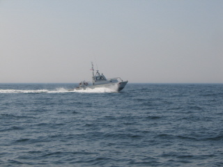
they had the dinghy alongside and were picking up the passengers. Then about 10 minutes later
this coast guard boat passed us headed to the scene. |
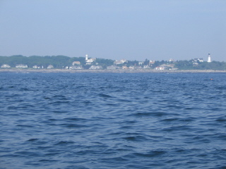 |
This is Cape Elizabeth, the entry to Portland Harbor, and to my view the
start of the real coast of Maine- below here its sandy beach coast, past here its
the rocky coast of Maine.
The seas increased a lot as we passed Halfway Rock, and by the time we got to Seguin
it was bordering on nasty. It was also very hot on shore- over 90F, so it was very hazy,
altough we were quite cool with the southwest breeze.
|
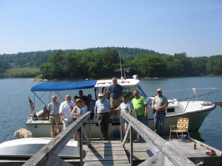 |
We were at my dock in Pleasant Cove by 2:30, and greeted by a group of friends
my wife had called to help welcome me home.
It was great to be home, and surrounded by lots of friends. |
Return to the trip log